About the Park
Channel Islands National Park is a United States national park that consists of five of the eight Channel Islands off the coast of the U.S. state of California, in the Pacific Ocean. Although the islands are close to the shore of densely populated Southern California, their isolation has left them relatively undeveloped. The park covers 249,561 acres of which 79,019 acres are owned by the federal government. The Nature Conservancy owns and manages 76% of Santa Cruz Island, the largest island in the park. Channel Islands National Park is home to a wide variety of significant natural and cultural resources. It was designated a U.S. National Monument on April 26, 1938, and a National Biosphere Reserve in 1976. It was promoted to a National Park on March 5, 1980. Channel Islands National Marine Sanctuary encompasses the waters six nautical miles around Channel Islands National Park.
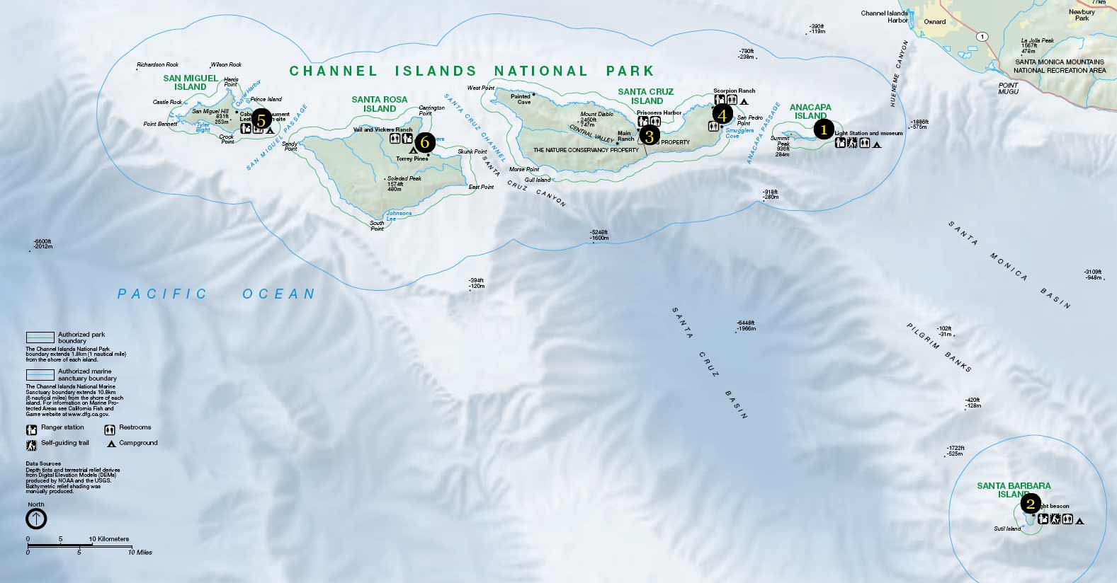
Points of Interest
Camping
No camping is allowed on The Nature Conservancy's western 76% of Santa Cruz Island. Limited backcountry camping is available on Santa Cruz and Santa Rosa Islands. Please refer to the Backcountry Camping section for more information. Camping Reservations: Advanced camping reservations are required for all of the campgrounds. There are no entrance fees to visit the park. However, a reservation fee is charged for camping on the islands. The $15.00 per night-per site fee includes both the National Park Service fee that supports the operation and maintenance of the campgrounds and the reservation fee charged by the contractor that manages the National Reservation Service
Lodging
Their is no inside lodging within the park. But outside of the park their is a varity of different hotels to pick from. For accommodations in Ventura, Oxnard, and Santa Barbara contact: Ventura Visitor and Convention Bureau Oxnard Visitor and Convention Bureau Santa Barbara Visitor and Convention Bureau
Park Hours & Fees
The park is open all year. However, the visitor centers in Ventura and Santa Barbara are closed Thanksgiving and December 25th. The Robert J. Lagomarsino Channel Islands National Park Visitor Center is open from 8:30 am to 5:00 pm daily. The Outdoors Santa Barbara Visitor Center is open from 11:00 am to 5:00 pm daily. Park Fees;There is no entrance fee to visit the Channel Islands National Park. As of July 1, 2015, Channel Islands National Park will no longer sell federal lands passes. The federal lands passes, including versions for seniors, active military, and the disabled, cover entrance fees at national parks and other federal lands. There is no fee to enter Channel Islands National Park.
Park Activities
Walking & Hiking: Many trails and roads traverse the islands, providing visitors with spectacular hiking opportunities. These trails and roads range from the maintained, relatively flat, signed trails of Anacapa to the unmaintained, rugged, mountainous, unsigned paths of Santa Rosa. Trail maps, guides, and topographic maps are available at park visitor centers and at island bulletin boards.